Total Vibe
65/100
About the Vibe
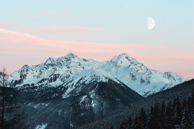
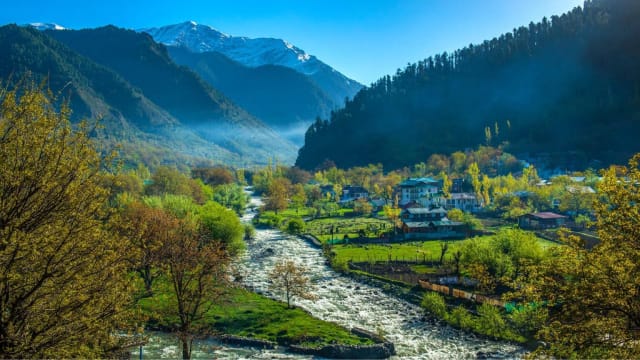
Remote village at 7,150 ft near Darjeeling with zero commercialization, sunrise over the 'sleeping Buddha' mountain silhouette, pine forests, and absolute tranquility
Altitude
2,180m
Above sea level
Crowd
Sparse
Typical density
Cost
₹1,000
Per day (mid-range)
| Primary vibe | Sleeping Buddha sunrise & Village walks |
|---|---|
| Best season | October-May |
| Ideal trip length | 4 days (Short Getaway) |
| Nearest airport | No airport within easy reach - arrive by road or rail |
| Monthly crowds | View the 12-month crowd calendar → |
Go in October-May. That's when Bagora is at its best - and the 4-day version of this trip actually fits.
When to come
FebruarySerene · 5/100 crowd
February is the quietest month here that is still in season - 5/100 on the crowd scale. January is the worst of the twelve at 31/100.
Dates to avoid
- 14-17 Jan — Makar Sankranti / Pongal (one leave day makes it longer)
- 23-26 Jan — Republic Day (one leave day makes it longer)
- 1-3 Jan — New Year's Day
Long weekends landing inside this place's best season - when a quiet destination stops being quiet.
Fewest people: Dawn on the ridge; the mountain is usually gone by nine. Arrive then for the view without the crowd.
Today's quiet window at Bagora
Share this destination with a friend to reveal our curator's secret tip for Bagora.
Unlocking also earns you MetryCoins
Insider Intel
Crowd-free 83 · Uniqueness 63
Visiting from abroad
Visa, permits for foreign nationals, and the nearest international gateway to Bagora
Show
Visiting from abroad
Visa, permits for foreign nationals, and the nearest international gateway to Bagora
Most nationalities can apply online for an e-Tourist Visa (30-day, 1-year or 5-year) instead of visiting an embassy. Apply at least 4 days before you fly; the 30-day visa can be applied for up to 30 days ahead, the longer ones up to 120 days ahead. Nationals of Nepal and Bhutan need no visa.
An e-Visa is valid for entry only at the designated international airports and seaports listed on the portal. Land borders are not on that list, so an overland arrival from Nepal or Bangladesh needs a regular visa.
Indian e-Visa portal (indianvisaonline.gov.in)No inner-line or protected-area permit regime is listed for West Bengal. Your visa covers the main tourist areas; districts along an international border can still run local checks, so carry your passport and a printed copy of the visa.
- Bagdogra (IXB) - about 38 km straight-line
- Guwahati (GAU) - about 346 km straight-line
Fly into the gateway, then use the domestic airports and transport listed above for the last leg. Road distance in the hills runs 1.3-1.6x the straight line.
Tourist SIMs (Airtel, Jio, Vi) are sold at international airport counters against your passport and visa; activation can take a few hours. Cards work in cities and larger towns; carry cash beyond them. UPI, the QR payment system you will see everywhere, normally needs an Indian bank account - some foreign visitors can get a prepaid "UPI One World" wallet at major airports.
Prices on this page are in Indian rupees. The currency selector in the footer shows estimates in yours.
Book your Bagora trip
Compare and book every piece - we point you to the best booking sites.
Partner sites open in a new tab. Some links earn travelmetry a commission at no extra cost to you - it keeps the platform free.
Today at Bagora
Unlock 14-day forecast windows
- 14-day weather + crowd ranked windows
- Tonight's moon + Milky Way visibility
- Wind, snow, altitude & UV risk flags
- Hour-by-hour crowd rhythm + insider tip
Air quality in Bagora
Destination Intelligence
Silence Index
92/100
🤫 Very tranquil
Ideal Stay
4 days
Short Getaway
Crowd Status
Low
Great time to visit
🌿 Carbon Footprint
From Kolkata
495 km139 kg CO₂
Flight
26 kg CO₂
Train
44 kg CO₂
Bus
🌱 Save 81% CO₂ vs flight
From Delhi
1101 km309 kg CO₂
Flight
59 kg CO₂
Train
97 kg CO₂
Bus
🌱 Save 81% CO₂ vs flight
From Chandigarh
1191 km334 kg CO₂
Flight
63 kg CO₂
Train
105 kg CO₂
Bus
🌱 Save 81% CO₂ vs flight
💜 Solo Travel Readiness
Moderate
How welcoming this destination is for solo travelers, based on infrastructure, community, and regional data
Research accommodations with good reviews from solo travelers beforehand
Stick to well-traveled routes, especially after dark
Keep local emergency numbers handy
Network is patchy here - download offline maps and share your live location while you still have signal.
Family-run homestays are the warmest, safest base for solo travellers here - hosts double as local guides.
📊 Based on NARI 2025 (National Women's Safety Index) & NCRB data
Vibe Fingerprint
Traveller Reviews
First-hand accounts from people who've actually been
FAQs About Bagora
How do I get to Bagora?
▼
Bagora in West Bengal is reached mainly by road; the nearest airport and railhead can be a long drive away. See the full "How to Reach" breakdown - air, rail and road with durations and fares - on this page.
What is the best time to visit Bagora?
▼
The best time to visit Bagora is October-May. This page breaks it down month by month with live weather, crowd levels and the best low-crowd windows so you can fine-tune the dates.
Will I see snow in Bagora?
▼
Bagora sits at roughly 2,180m. Whether snow is on the ground depends on where the freezing level sits that week, not just the month - it can be a winter wonderland one week and bare the next. This page runs a live Snow Line instrument comparing today's freezing level against Bagora's altitude, plus any fresh snowfall in the 7-day forecast.
Is Bagora safe for solo travelers?
▼
Bagora in West Bengal is generally considered safe for solo travellers who take standard precautions. It's a quiet, low-footfall place, so tell someone your plan, carry offline maps, and don't count on late-night transport or reliable network.
What should I pack for Bagora?
▼
Packing depends on the season and activities. Generally, pack comfortable walking shoes, layers for varying temperatures, and any activity-specific gear. Check the altitude and weather conditions before your trip.
Are there ATMs and mobile network in Bagora?
▼
ATM availability and mobile network strength vary by destination. We recommend carrying some cash and downloading offline maps before visiting remote destinations.
Vibes like Bagora
Destinations with a similar geometry across crowd, scenery, uniqueness, and budget.